|
The Corps of Engineers' Center Hill Dam
|
|
|
This beautiful dam is located on the Caney Fork River, near Silver Point
in north central Tennessee. The Caney Fork is a major tributary to the
Cumberland River, joining it at Carthage, TN, not too far downstream
from Cordell Hull Dam. Center Hill is a 250 foot high concrete gravity
structure, augmented with an earthen dike. A saddle dam (size
unspecified), just upstream from the main dam, completes the impounding
structure. The dam was closed in 1948, the powerhouse was completed in
1950
|
|
|
Center Hill Lake is a major player in flood control for the Nashville
area. Normal winter pool is about 632 feet MSL (648 in summer), but the lake can be
taken all the way to 685 MSL if necessary. At that level about 762,000
acre-feet of water can be stored above normal levels. It was about 660, and
spilling (obviously!), when we visited in March 2002.
|
|
|
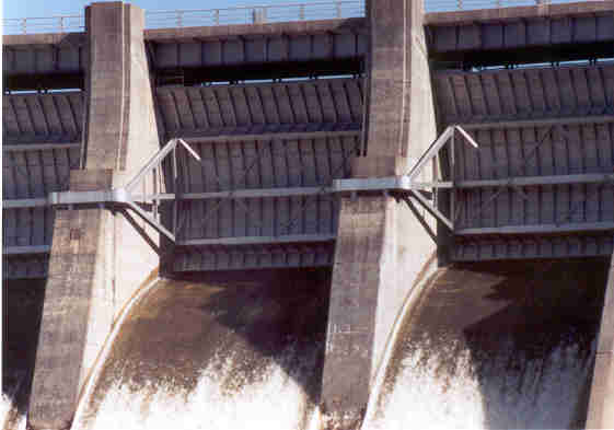
A closeup of the one of the floodgates. The amount of water being
released can be estimated by the amount that the gate is raised.
|
|
|
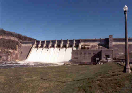
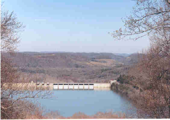
This was actually the first view of the dam that we got. As we came
towards Edgar Evins State Park, we approached the dam from the rear,
crossed over the dam, made a hard left and pulled into a parking lot. We
could see that we were in for a treat!
|
|
|
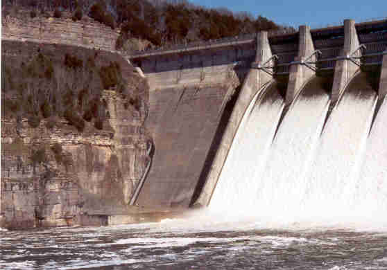
A view of the left abutment of the dam. The cliff is why the roadway
makes a 90 degree turn as you come over the dam to that side. Notice the
seepage coming through the rock.
|

|
|
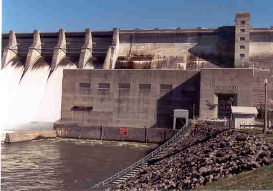
Another view of the powerhouse. Notice the stairway descending into the
water. The river was obviously running higher than normal.
|
|
|
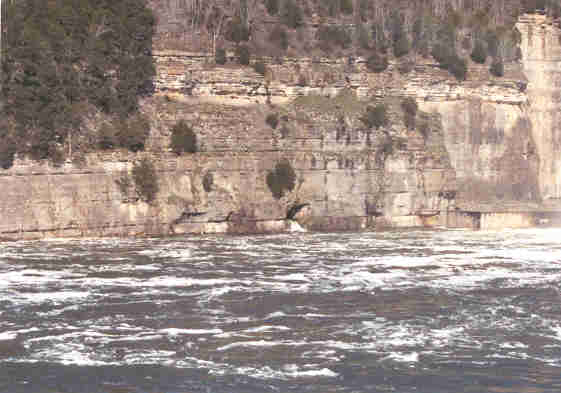
Another view of the sheer rock on the northeast side of the riverbed.
Also notice more seepage from the hole in the rock, just above the
turbulent river.
|
|
|
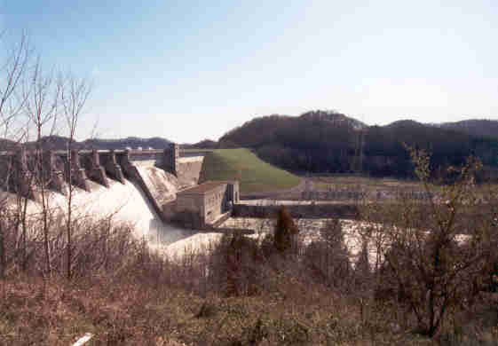
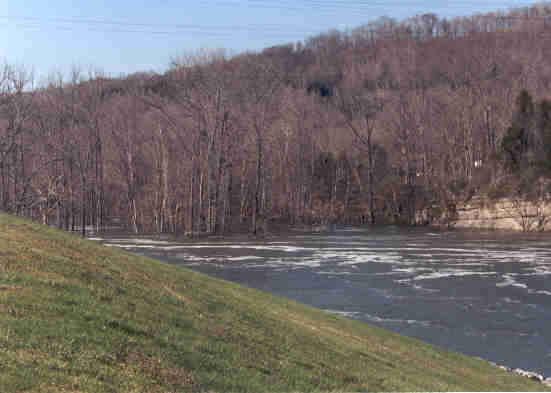
And a look down the swollen river. The trees in the middle are on a
submerged island. Flood control is always a delicate balancing act
between the lake level and the river level downstream. Here the river is
allowed to get a little out of its banks, but not devastatingly so, in
order to not raise the lake level too much and cause damage upstream.
|
|
|
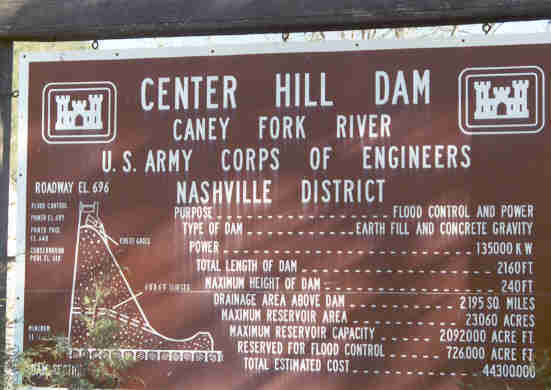
The specifications. Although the power output is given as 135 Megawatts,
the water management page on the Nashville District ACOE website stated
that the dam was consistently generating close to 160 Megawatts, probably
due to upgrades since the dam was built and this sign placed.
|
|
|
And once we got to the park, we got this view of the back side of the
dam. We shot this one the following morning so the sun would be in the
right place. Its not visible in the picture, but you can see the cooling
tower at what would have been the Hartsville Nuclear Plant from here.
|