|
APGI's Santeetlah Dam
|
|
|
By far the most interesting development in this project
is Santeetlah Dam and Powerhouse. The dam is on the Cheoah River, 9 miles
upstream from where it joins the Little Tennessee River. The powerhouse is 5
miles away on the Little Tennessee River, five miles upstream from Cheoah Dam.
Santeetlah Dam diverts the Cheoah river into a conduit consisting of 5,821 feet
of steel pipe, 19,355 feet of concrete lined tunnels, and and a pair of 947
foot long penstocks. The total head is about 663 feet, but the resistance of
the conduit reduces that by about 60 feet, so the effective head is around 600
feet. The conduit and powerhouse can handle 898 cfs of water. At that flow the
two turbine/generator assemblies can generate 45 megawatts.
|

|
|
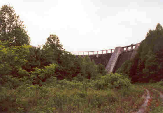
Santeetlah Dam was difficult to photograph because of the
terrain and vegetation. We got what shots we could the first time...here is a
view of the far spillway. There is a gated spillway at each end of a central
arch overflow section. At first we thought each spillway had two
floodgates.
|
|
|
We got this view of the pipline coming out of the dam.
After we left the dam, we tried to find a spot where we could get a better shot
of the entire dam, but the vegetation was just too thick. We figured we would
have to come back in the winter when the leaves are off the trees.
|
|
On the second Tapoco Quest, after we visited the
Calderwood development, we went to a Tapoco open house held at the library in
Robbinsville, NC. There we met Mr. Norm Pierson, the one who had gotten us
access to Calderwood. He gave us permission to walk in on the access road at
the base of the dam. We were able to get some better shots, but we still ended
up too close to the dam. So we are continuing to plan a winter quest.
|
|
|
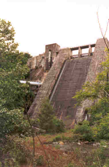
After hiking in about a quarter of a mile, we finally got
clear enough of the vegetation to start taking pictures. Here is is obvious
that the spillways have three floodgates, not two. The dam is about 1,054 feet
long by 216 feet high.
|
|
|
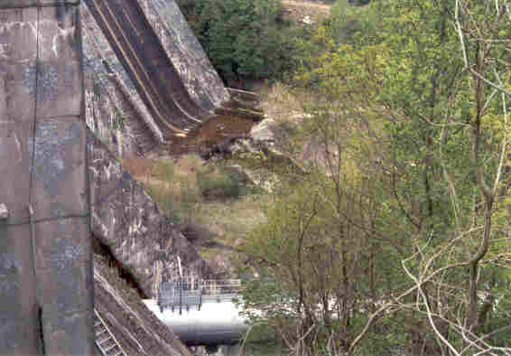
Here is a view of the other spillway, and the pipeline
exiting the dam. From above it looked like the pipeline was on the ground. The
center of the pipeline is actually about 87 feet below the normal full pool of
1940.9 feet elevation, so it is roughly halfway up the dam. The pipeline
disappears into the vegetation...presumably it enters on of the five tunnel
sections somewhere close by.
|

|
|
Looking back as we left.
|

|
|
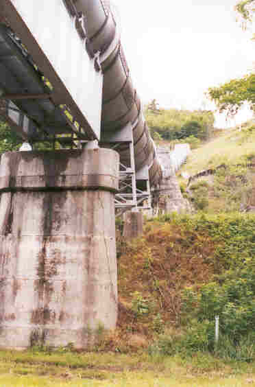
The pipeline crosses at least three roads. Here is a view
as it exits a tunnel and comes down a hill as it crosses NC 28/US 129.
|

|
|
This looked like a joint between sections, as it crossed
the road
|
|
|
As it crosses NC28, it also crosses Yellow Creek Road,
between the two steel support sections shown here. The clearance is 14.9 feet.
Finally it ascends and enters another section of tunnel. Norm told us that
somewhere close to here there is a section of pipe that can be rolled out of
the way to allow equipment to access the tunnels for maintenance. Periodically,
workers hike all sections of the tunnel and pipeline for internal inspection.
The longest tunnel section is about two miles.
|

|
|
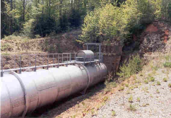
This section is exposed close to the end of the line
where the surge tank and penstocks are located. We found this section while
exploring the road from Fontana Village to Tapoco.
|
|
|
At first, we opined that maybe this was a high spot and
they purged air here. While that may still be a possiblity, we know now that
this is an access point.
|

|
|
The end of the line.
|

|
|
A closeup of the powerhouse. This section of Cheoah Lake
is mirror smooth at times. We were trying to get the reflection of the
powerhouse in the lake when it started raining slightly, diffusing the
reflection somewhat. Also notice the requisite "Stay Away or You Will Die"
sign.
|

|
|
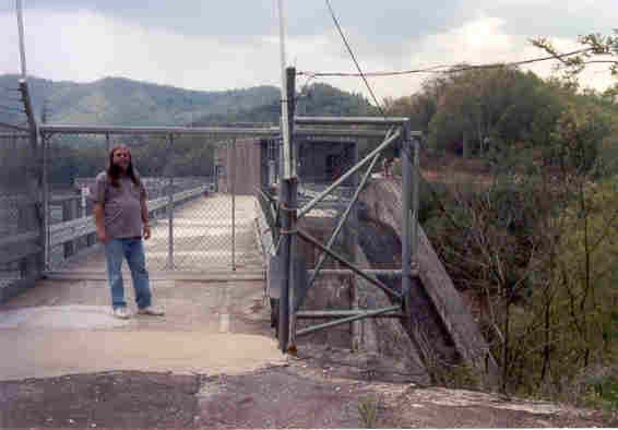
During the second quest, we found the access road to the
switchyard and power house. Here is Pat at the gate to the switchyard, the
powerhouse is visible to the left, and the surge tank is visible top
center.
|
|
|
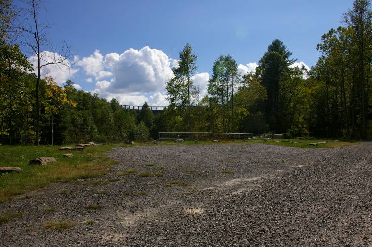
When the Tapoco Project was relicensed by the FERC in 2005, APGI agreed to
a minimum release into the Cheoah River channel, augmented occasionally by
a high level release for recreational purposes... rafting. To accomodate the
rafters, a new parking area and "launch pad" have replaced the
old road bed I hiked in on. We found this during a visit in October 07.
|
|
|
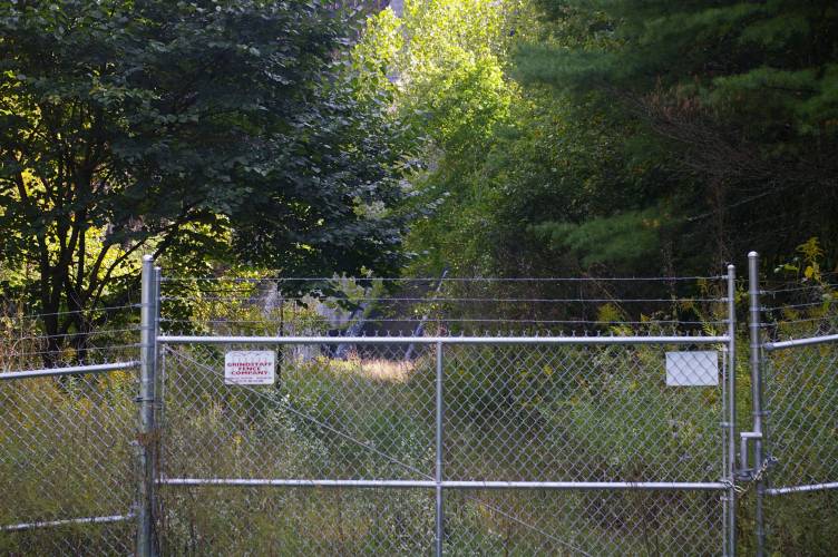
But, maddeningly, stops just short of the dam itself. And plenty of trees
still block the view.
|
|
|
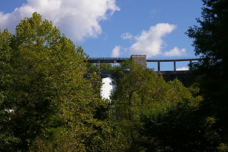
Still, we were able to catch this shot of a spill from
one floodgate. Santeetlah was only about 4 feet low, even though this area
is suffering a severe drought.
|