|
Nantahala Power and Light's Nantahala Dam
|
|
|
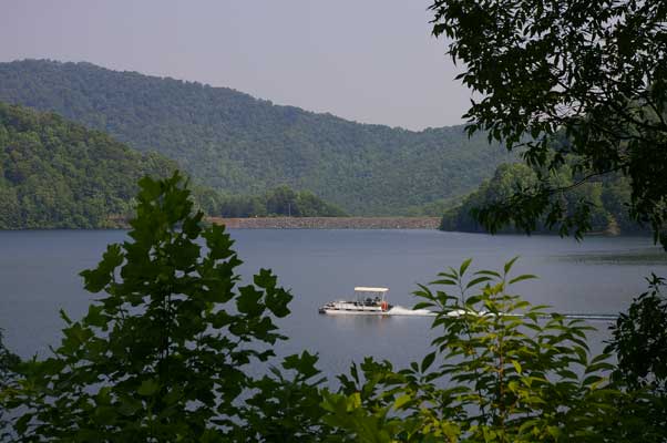
This is the only view we got of Nantahala Dam. We found Nantahala Dam
Road, but it was gated well out of view of the dam itself. The dam is a
rockfill type, 1,042 feet long and 250 maximum height. There is a
controlled spillway on the east side of the dam with four Tainter gates
25 feet wide by 19 feet high, and two erodible fuse plugs... NP&L must
like the fuse plugs! The lake is 1,605 acres at full pond of 3,012.2
feet MSL, with total volume of 137,000 acre-feet. It is NP&L's biggest
impoundement, draining 90.7 square miles with an average inflow of 350
cfs.
|
|
Construction of this project was started in March 1930 by NP&L, but was
suspended in July 1931 due to "adverse business conditions" (can
you say "depression"??). Work finally resumed in July 1940;
the dam was closed on January 30, 1942 and "first light"
occured on July 6, 1942. In 1966 NP&L submitted a license application
to the FERC; in 1981 (!?) license number 2692 was issued.
|
|
|
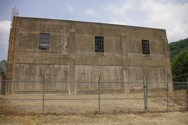
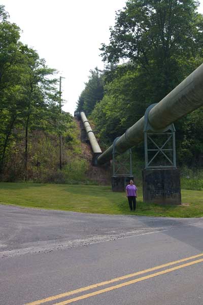
Water from the dam flows through a tunnel/pipeline for a distance of
27,633 feet to a surge tank, then an additional 1,991 feet to the
turbine. The connected generator is rated at 43.2 Megawatts; hydraulic
capacity is given as 724 cfs. Design head is 965.5 feet... not sure what
the actual head is.
|
|
|
|
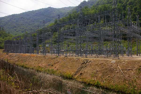
It looked like there may be a couple of circuits coming out of here,
hence a little more elaborate switchyard.
|
|
|
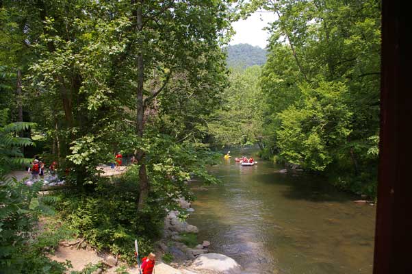
Just across the street, the tailrace joins the Nantahala River, and
rafting begins! NP&L (now known as "Duke Power Nantahala
Area", or DPNA) schedules production here primarily to suit
recreational interests during the spring though fall.
|
|
|
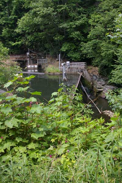
Somewhat out of the ordinary is the fact that there are two addtional
"diversions" that add (or added) water to the project. First
is Whiteoak Creek Dam, on (oddly enough) Whiteoak Creek, a tributary to
the Nantahala River that would join some distance downstream of
Nantahala Dam. The water is piped over to join the main Nantahala
pipeline. It is a concrete gravity dam, 115 feet long by 16 feet high.
|
|
|
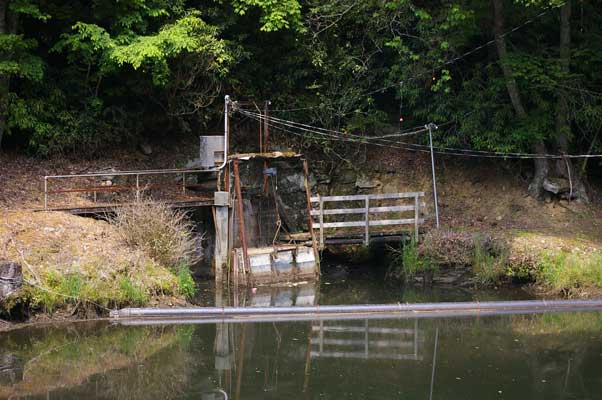
Not to hurt anybody's feelings, but this dam looked like a hillbilly's
do it yourself project... probably like something I would do!
|
|
|
After driving by it three times, we finally found Dick's Creek Dam,
tucked into the bushes right beside the road. Its not that small... the
dam measures 109 feet long by 16 feet high, but the vegetation is so
thick it almost completely hides the thing. We heard it well before we
saw it! We never did see the Diamond Valley dam, a 39 foot by 4 foot
high concrete structure, that diverts an unnamed tributary into
Dick's Creek 0.2 acre "reservoir".
|
|
|
From the diversion pond water used to be piped via this pipeline (2 foot
diameter) to the main Nantahala pipeline, but in 1999 Duke agreed to
stop this diversion. Now all the water flows over the dam to continue
down Dick's Creek to the point where it joins the Nantahala River. In
addition, apparently some of the water from the Whiteoak diversion is
allowed to "leak" into Dick's Creek at the pipeline junction,
to augment the flow into the bypassed reach of the Nantahala River.
|
|
The crest elevations of the two diversions was given as roughly 3,026
feet, higher than the main lakes level of 3,012, so hopefully no
unexpected "feedback" will occur!
|
|
|
|
|
|
|