|
Georgia Power's North Georgia Hydro Group
|
|
In the early 1900s, the Georgia Railway and Power Company
(predecessor to the current Georgia Power Company) built a series of dams on
the Tallulah and Tugalo Rivers to supply power to Atlanta.We bagged 'em all on
a Dam Quest based at Black Rock Mountain State Park.
|
|
|
The northern most dam is Burton, impounding Lake Burton.
It originally was meant for storage for the Tallulah Falls plant, but later a
plant was added locally producing 6 megawatts. It is a concrete
gravity dam, 128 feet high and 1,110 feet long, and was finished in 1919.
|
|
|
The next is Nacoochee Dam, impounding Lake Seed. It was
completed in late 1926, and is a gravity dam standing 75 feet high and
490 feet long. It produces about 4.8 Megawatts of power.
|
|
|
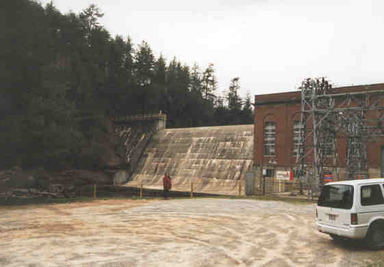
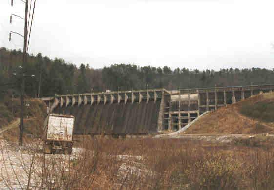
Further downstream is Mathis Dam, impounding Rabun Lake,
and supplying the Terrora Power Plant (don't ask me, I didn't name them!). This
dam is proudly billed as an "Ambursen type construction" dam...
which is basically a thin sheet of concrete reinforced with connected
buttresses on the downstream side. If you look at the dam, it is
a little different from any others we have seen. Outside the spillway, the
construction appears to be a bunch of chambers as opposed to solid
concrete. Completed in 1915, the dam stands 108 feet high and 660 feet long.
|
|
Originally built for the same purpose as Burton, to store
water for the Tallulah Falls Plant, it was later decided to add a plant at the
dam. Eventually that was abandoned in favor of locating the plant just behind
the Tallulah Falls dam, and take advantage of an additional 100 feet of head.
So now Mathis diverts the flow into a mile long tunnel to the Terrora Power
Plant, with a capacity of 16 Megawatts
|
|
|
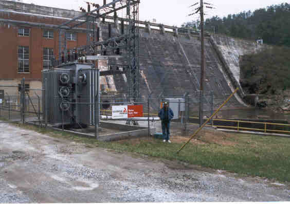
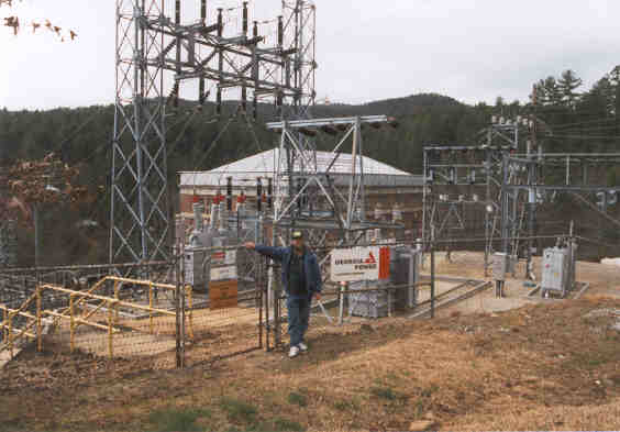
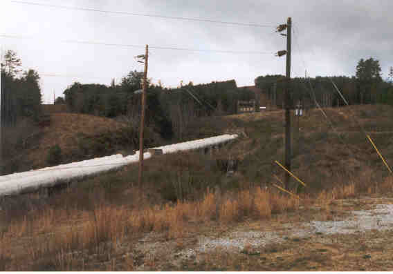
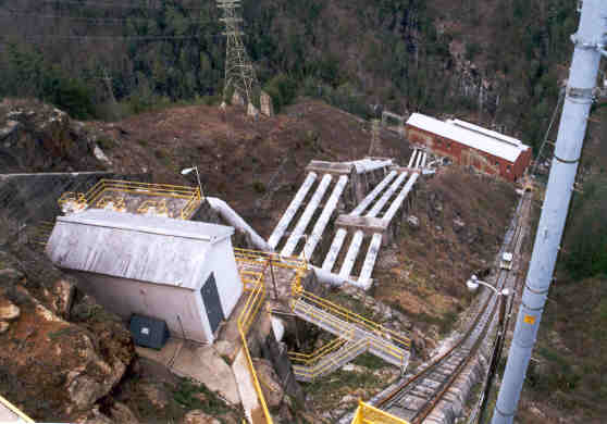
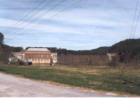
This is the Terrora Power House and Switchyard. The
penstocks feeding it are seen below.
|
|
|
|
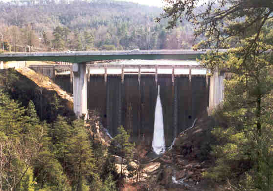
This is the Tallulah Falls Dam. As you can see, it is
right at the bridge for US 441. In fact, you can't see the dam as you drive
over the bridge. This is another diversion dam: the water is sent through a
6,666 foot (thats what it said!) tunnel to the surge chamber above the power
house. The dam is 126 feet high and 426 feet long and was completed
in 1912.
|
|
|
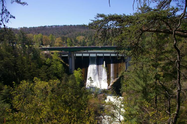
Coming back from our Cherokee Trip in April 07, we caught it spilling.
Georgia Power schedules several spills every year, ranging from 200 cfs
"aesthetic" spills to 700 cfs for rafters. This was a 700 cfs
spill. Since you can't see the dam from the road, we actually drove by
it, until Jan noticed a parking lot reserved for "Rafters
Only"! A quick U-turn, and here you go!
|
|
|
The total head is over 600 feet, and the plant is capable
of 72 Megawatts. For comparison, the combined capacity of the rest of the group
is about 94 Megawatts. Altitude makes a difference! Also notice the railway
next to the penstocks. This was used during construction, and is still used
today for access to the plant. Unfortunately, it is not open to the public, but
at least access is allowed to the upper parking area. The gates are closed and
locked when the crew leaves work for the day at about 3:00 PM, so be aware of
the time. We were able to talk to one of the guys, and he gave us a brochure,
which is the source of most of our information about the group. We're very
appreciative because we were unable to find another copy of the brochure
anywhere, and we fear it may be out of print now.
|
|
|
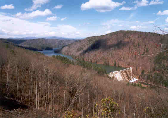
One of the most breathtaking views is that of the Tugalo
Dam. As you can tell from the picture, it is off the beaten path. There is a
one lane unimproved access road back into the woods, not in too bad of shape up
to this point; the old family truckster negotiated it without difficulty. As
you make the drive, you approach a "shinbone" ridge, and you can tell it by the
increasing visibility. All of a sudden you pop out into the open, and there it
is! This view shows the lake and the convergence of the Tallulah and Chattooga
Rivers to form the Tugulo River. The head at the dam is almost 150 feet, and
the plant is capable of 45 Megawatts. The dam stands 155 feet high
and 940 feet long, and was completed in 1923.
|
|
You can continue on the road
as it descends into the gorge to get to the base of the dam and the power
house. Its a little rougher because of the descent, but the Caravan made it
with no problems. Georgia Power also maintains a campground there. There is a
public restroom with running water, but no other facilities.
|
|
|
Finally, we get to Yonah Dam. Believe it or not, this was
the hardest one to find, because we didn't have good maps at the time. After
criss-crossing the river, we finally stumbled across Yonah Dam Road (duh!),
drove about 5 miles upstream, and thar she blows! In the bag now, Yonah has
about 70 feet of head and is capable of 22.5 Megawatts. The dam is
90 feet high and 980 feet long, and was completed in 1925.
|
|
The Tugalo River flows into Lake Hartwell and becomes
part of the Savannah River, the border between Georgia and South Carolina, and
empties into the Atlantic Ocean.
|
|
While doing other research in June of 2001, we
discovered there is now another development that is considered part of
the North Georgia Hydro Group, the Estatoah Development, near Mountain
City. It must be a small one, since its capacity is only listed at 240
Kilowatts... about a quarter of a Megawatt. But we'll have to add it to
the group when we get a chance.
|