|
TVA's Fontana Dam
|
|
|
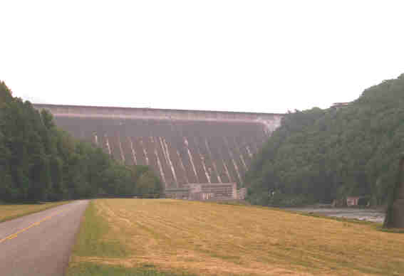
Fontana Dam is on the Little Tennessee River, near Robbinsville, North
Carolina. At 480 feet, it is the tallest concrete dam east of the
Rockies. Construction started January 1, 1942, and amazingly took only
three years to complete. The lake started filling in November 1944, and
electricity was first generated January 20, 1945. Also there is very
little steel in the dam (it was World War II, so there was little steel
available), so they did some creative things with re-enforced concrete.
The dam is 2,365 feet long. Three generators can produce 225 Megawatts.
|
|
There is a Visitors Center at the top, so lets go!
|
|
UPDATE! The tram to the powerhouse was
closed for the 2001 season. It seems it needed some expensive repairs,
and while TVA was debating about reparing it, 9/11 happened. Sadly, now the
tram and powerhouse tours are history, but at least the Visitor's Center is
still open, except during high security alerts.
|

|
|
The dam from the Visitors Center.
|

|
|
Looking down the tram to the powerhouse. Its open to the
public, so...
|

|
|
...here we go! (Gulp!! Don't even think about how many
cubic feet of water is on the other side!!)
|

|
|
In the powerhouse, two of the three generators.
|

|
|
And the control room. Unmanned, as usual these days.
|

|
|
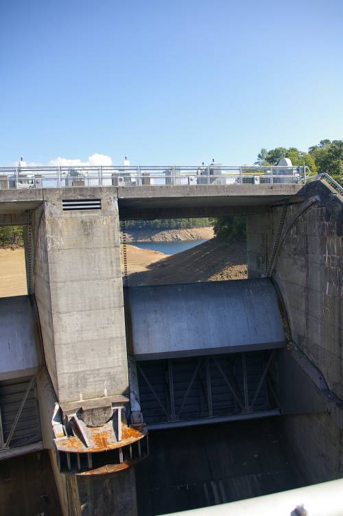
Back on top, there are no conventional spillways for the
floodgates. Instead, notice the two curved barricades Jan is standing
between.
|

|
|
Inside each are two somewhat conventional
floodgates...
|

|
|
...but they dump into a tunnel.
|
|
|
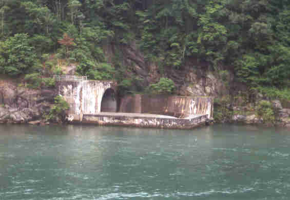
The tunnel empties at river level. Notice the concrete
around the exit...it breaks the flow, actually throwing water high into the
air, when in use. This is to reduce erosion of the bank. The other tunnel exit
is just downstream, just out of view on the right side of the picture.
|
|
|
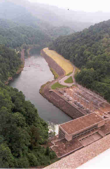
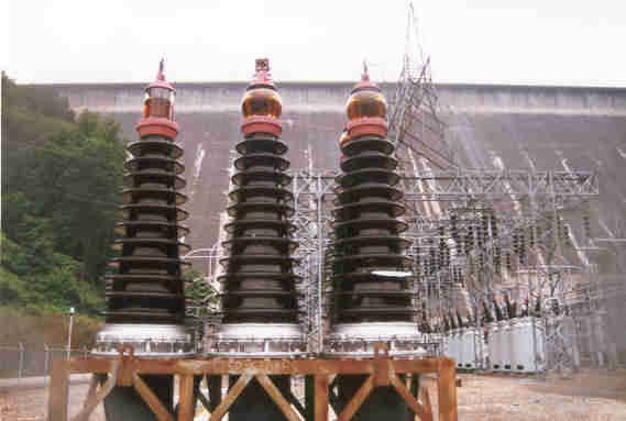
A view of the powerhouse, switchyard, and river from the dam.
|

|
|
The Visitors Center from the dam.
|

|
|
A look back over the dam from the center. There is a
roadway across the dam that was closed for maintenance while we were there. I'm
sure the dam would have been off limits, except that this is how the
Appalachian Trail crosses the Little Tennessee River. So they at least left it
open to foot traffic.
|

|
|
As we leave the dam, we come across this structure. In
case the flood gates at the dam were not enough, this is literally an overflow.
If the water level gets high enough to breach the wall, it flows into yet
another tunnel, and exits a little farther downstream from the main floodgates'
discharge. So far, it has never been needed.
|
|
|
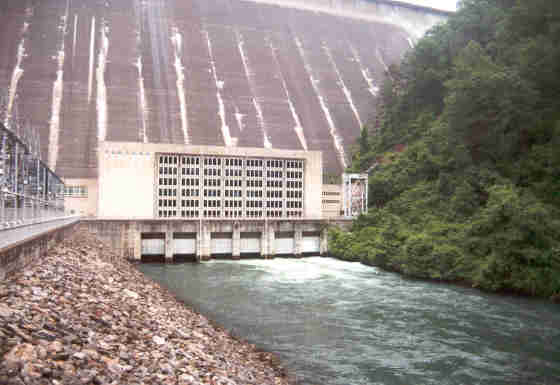
The dam and powerhouse from river level.
|

|
|
The switchyard and dam. Again, Fontana is capable of 225 Megawatts.
|
|
|
Spare parts?
|
|
|
During a visit during October 2007, we observed the lake at 65 feet below full
pool, already 10 feet below the normal winter pool. The drought has been bad
this year: North Georgia is under a total outdoor watering ban at this time,
and most of the TVA lakes are very low.
|

|
|
I should have been about 20 feet or so underwater at this point...
|

|
|
The back of the floodgates, high and dry.
|
|
They are still generating here: TVA is trying to maintain minimum stream flows
downstream. We found it curious that Duke, at Nantahala and Thorpe, and APGI,
at Santeetlah, have been able to keep their lakes much closer to full pool.
Naturally, TVA is currently catching a lot of flak about Fontana's level. Releases
from Natahala and Thorpe end up in Fontana Lake. Santeetlah's releases are downstream,
into Cheoah Lake if through the power house, or into Calderwood Lake if spilled
at the dam.
|