|
USBR's Glen Canyon Dam
|
|
|
Not as famous as Hoover (although some of the locals will argue that
point!), Glen Canyon Dam is located on the Colorado River at Page
Arizona. The dam is almost as big as Hoover; the locals will say bigger!
It stands 710 feet high to Hoover's 726.4, and is 1,560 feet long to
Hoovers 1,244. The hydraulic height above streambed is 583 feet compared
to Hoover's 576, and it contains some 4,901,000 cubic yards of concrete,
more than Hoover at 4.4 million... OK, it IS bigger than Hoover! It is a
concrete thick arch dam with the crest elevation at 3,715 feet MSL.
Construction spanned 1957 to 1964.
|
|
|
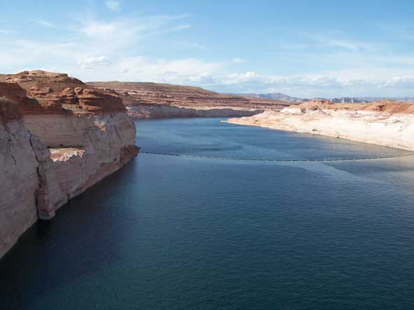
Glen Canyon Dam impounds Lake Powell, the second largest man-made lake
in North America. At full pool of 3,700 feet it can store 21.5 million
acre-feet of water, and is 560 feet deep at the dam. It stretches some
186 miles upstream, and has a surface area of 162,700 acres. That's at
full pool, however, and there are those that believe that the lake will
never see full pool again. Lake Powell, Lake Mead behind Hoover, and
other water storage projects on the Colorado River, are being taxed by
increasing demand for the water they collect, and some believe that the
last half of the 20th century was a fluke: that "normal" runoff
in the upper Colorado basin is much less, and that demands already are
outstripping supply. Some are clebrating the return of the upper reaches
of Glen Canyon as the Lake recedes, some are blaming global warming, the
government, etc., etc... controversy aplenty! Do a search on "Lake
Powell" to see some of the stories and make up your own mind.
|
|
|
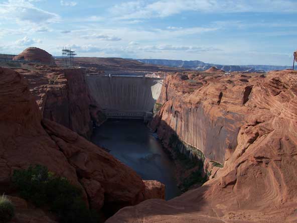
This is a view from a platform in a park within the town of Page, AZ.
When they say "canyon", they are not kidding!
|
|
|
We visted in May of 2005, when the level was about 3,565, or 135 feet
below full. Notice the white stain, caused by mineral deposits,
indicating "normal" lake levels. Also in this view is one of
the two channels leading to spillways. These spillways can release
276,000 cfs from a pool of 3,711 when necessary. The spillways were used
in 1980, when the lake hit "full" for the first time, and
again during flood conditions in 1983. The channels were damaged in that
event: some feared the dam would fail. After repairs were made, changes
were made in procedures to prevent the lake from filling as fast.
|
|
|
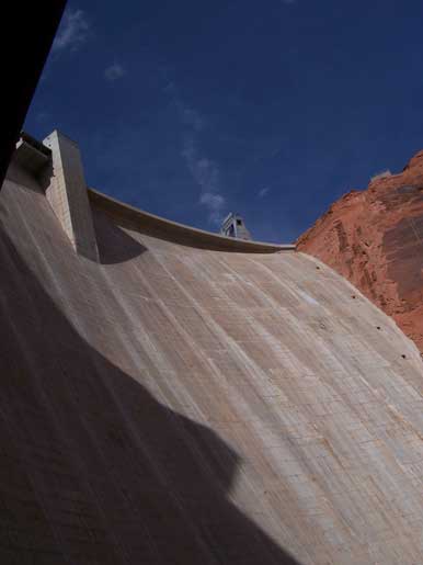
A look up the face...
|
|
|
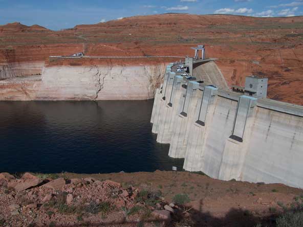
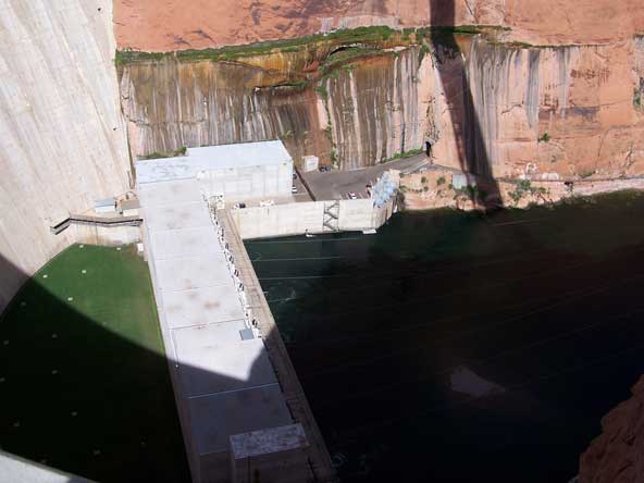
And a look down at the powerhouse, and a parking area. We would pass
through there the next day when we took a raft trip down the river.
|
|
|
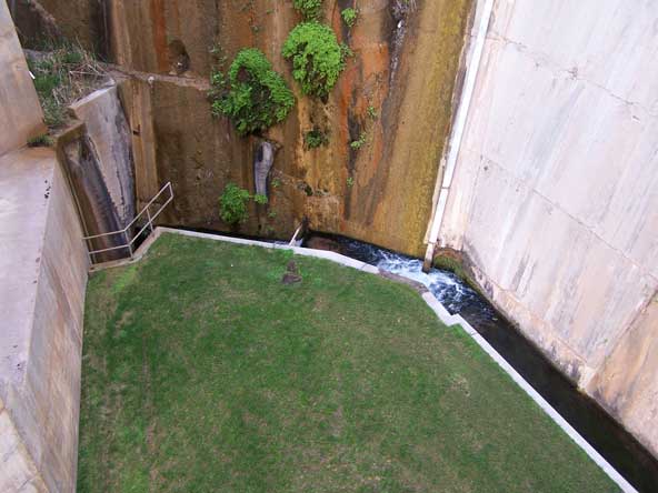
A closeup of "seepage control" and... grass?? According to the
tour guide, after the power house was put into operation, severe
vibrations were caused by the water falling some 400 to 500 feet
through the penstocks. Dirt was placed in this area to dampen
vibrations, but the wind kept blowing the dirt away. So, grass was
planted to keep the dirt in place. Wonder who has to mow the lawn?
|
|
|
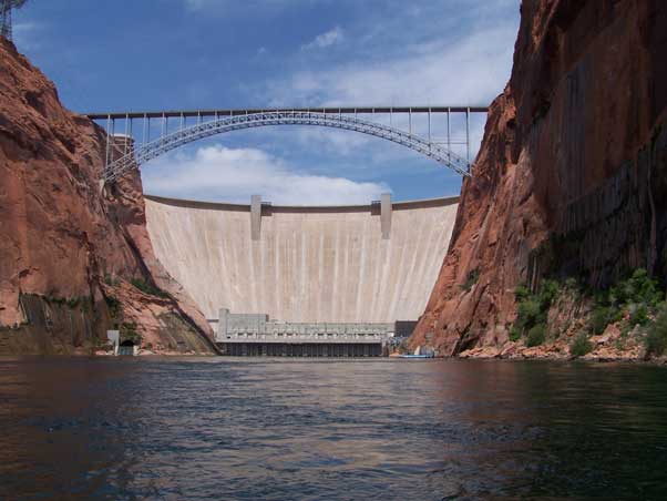
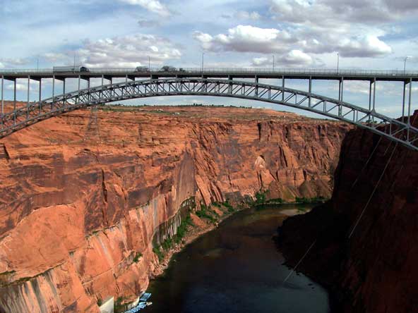
A look downstream, and a view of the bridge. This bridge is 700 feet
above the river, and over 1,000 feet long. There are no railroads in the
area (excepting the landlocked
BMLP, but thats another story), so
this bridge was built to aid in construction of the dam. Again, one up
on Hoover, where they waited until well after the dam was built before
they built a bridge (currently under contruction)...
|
|
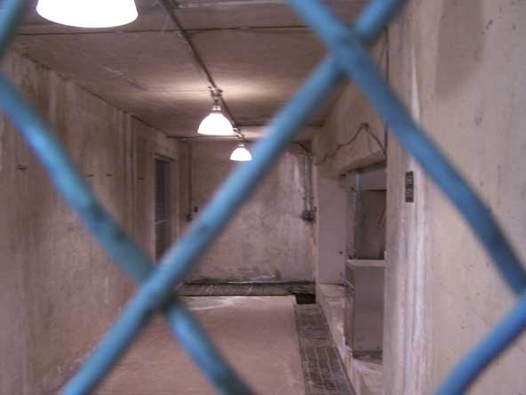
A look inside... literally! This is a peek into one of many inspection
chambers, where the health of the dam can be evaluated.
|
|
|
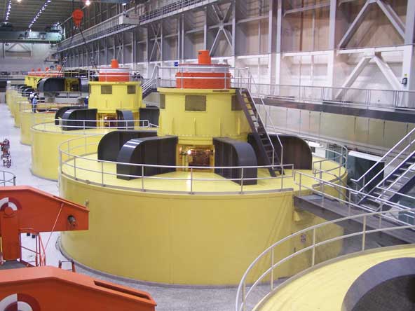
The power house has 8 turbine/generators that are
collectively rated at 1,304 Megawatts, and is fiscal 2005 they generated
3,217,926 Megawatt-hours. The design head is 510 feet,
the hydraulic capacity is 33,200 cfs. A bypass can release an additional
15,000 cfs if needed
|
|
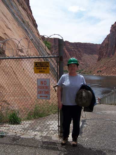
The next day, we took the raft trip down the river, starting at the dam.
Because of the bridge overhead, its a designated "hard hat
area"... but we didn't get to keep them! Shucks...
|
|
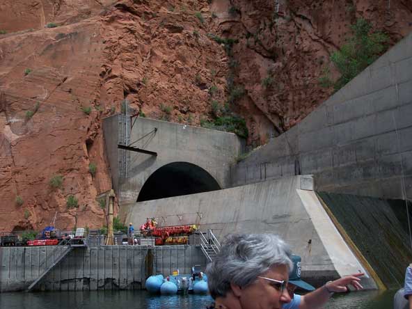
The jumping off point for the trip was next to the business end of one
of the spillways.
|
|
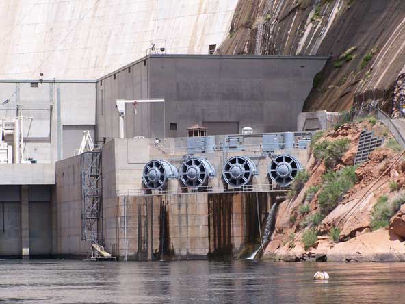
A view of the outlet works, used when generating doesn't release enough
water, but not so much so that the spillways are needed.
|
|
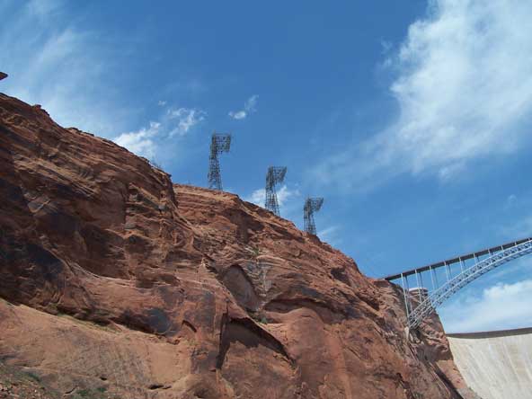
These towers bring the power lines up from the power house to the switchyard.
|
|
A picture from the
USBR...
|