|
The Best State Park
|
|
Desoto State Park is near Fort Payne in DeKalb County,
Alabama. It is on top of Lookout Mountain, a range that extends from
Chattanooga, Tennessee to Gadsden, Alabama. The Lookout Mountain Scenic Parkway
traverses the entire length of the mountain, and goes right through the park.
It is easily accessed from I-59 in Alabama, and relatively easily from I-75 in
Georgia. The Park has a Motel and Lodge, featuring a Restaurant that is open
year round, and Cabins and modified A-frame Chalets. The Cabins and Chalets are
fully equipped for cooking. There is also camping, either vehicle or primitive.
There are miles of trails to walk, and a couple of bicycle trails, although there are
more miles of unimproved roads to mountain bike on, if that is your thing. One
of the nicest things about the Cabins and Chalets is they are not very close
together. In fact, when the foliage is out, you generally can't see the
neighboring cabins.
|
|
|
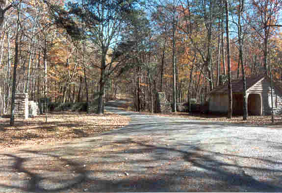
This shot is of the original "official" entrance to the park, as built by the
CCC. This is on DeKalb Country Road 618, which turns into the park here.
Going straight, the pavement ends, and County Road 66 starts, which continues down
the west brow of the mountain, eventually to hit the new "main
drag" down the top of the mountain, County Road 89.
|

|
|
We think they should make this gatehouse one of the rental cabins. The road
does see a little traffic, but not very much. This road goes to the primitive
camping areas, the campground, and the "General Store". It also
goes close to the CCC Rock Quarry, which is one of the few things we have
not seen yet. And you can get to the Knotty Pine Resort, a private facility
that borders on the park. We have stayed there once, when we came up on short
notice, and there were no cabins available in the park.
|
|
The Little River runs through the park, and in fact you
have a "mini-version" of Little River Canyon right there in the Park.
(DO NOT miss the chance to see the real thing, however!). You can hike down to
and along the river, but the trails are pretty rough in spots. There are easier
trails along the rim, and an interpretive trail into the middle of the park.
|

|
|
One of the bike trails is the so-called "CCC Road" that goes from the end
of the main road at Chalet #21 to the southern park border. This trail is
maintained as a jeep road for emergency access to the Desoto Scout Trail, which
corresponds to the river edge trail in the park (it extends northward to the
nearby Comer Scout Reservation). The CCC Road is an easy 1.75 mile in and out
walk (3.5 miles total), going down 300 feet or so into a gulf, with a pleasant
little surprise at the end. Be sure to ask Park
Superintendent Talmadge Butler about his plans for this.
|

|
|
The Park was built on the 1930s by the Civilian
Conservation Corps. The original Lodge building is still there, and is enclosed
by the new Lodge exterior. The dining rooms are all part of the old Lodge. The
Cabins were all built by the CCC; the Chalets were added later. We have stayed
in the Cabins once or twice, but we prefer the Chalets. We have also stayed in
the Motel when we have gone up on short notice. All of the accommodations are
very nice.
|

|
|
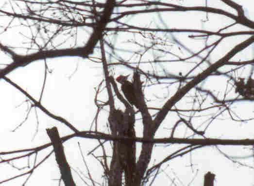
One of the things we like to do there is birdwatch. On one trip we were eating
breakfast at the lodge. Jan looked out the window and said, "Look at that
woodpecker!" Pat said, "I see him. He's getting a drink out of the puddle!"
Jan replied, "How can he be drinking? He's hanging on the side of that tree!".
Turns out there were three different kinds of woodpeckers visible at the same
time, from the dining room window! We captured this not too good shot of
a Pileated Woodpecker while hiking there on the same trip.
|
|
|
And we managed to grab this one the last time we were there. This was
one of the first shots from our new 80-320 zoom that we got for the new
camera.
|
|
|
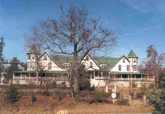
If you follow the signs to the park, you will go through "downtown"
Mentone, AL, where you will be treated to a view of the Old Mentone Hotel.
It is in the process of being restored, and is currently operating as a
Bed and Breakfast. We have never stayed there, but we did eat supper there
once (excellent!).
|

|
|
About halfway between Mentone and the park proper, is DeSoto Falls.
See the Dams on the
Little River page for a picture of A. A. Miller Dam, which is located
here also. The last dam, Howard's Dam, is right on the park border. The
first time we encountered the dam was when we were hiking the rim trail for the
|
|
|
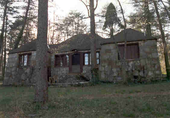
We also encountered this beautiful rock house on the rim trail, right before
we got to the mill area. We don't know if it is connected to the park...
we keep forgetting to ask!
|
|
|
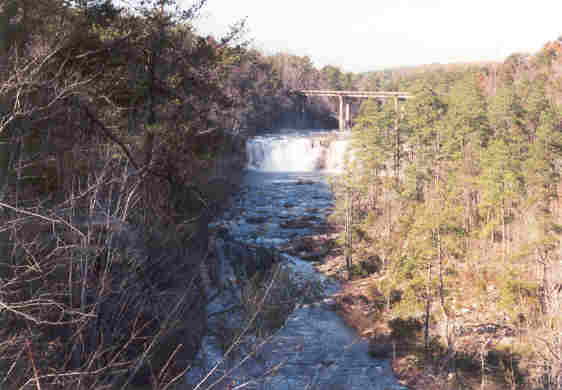
And, like we said, do not pass up the opportunity to see Little River Canyon.
This is a shot of Little River Falls from the first overlook on the
Canyon Rim Drive.
|

|
|
Close to the park is the Cloudmont Ski and Golf Resort and Shady Grove
Dude Ranch, which we believe is all part of the same organization now.
We have never stayed there, but have visited a couple of times while
exploring. That is where we bagged one of the Dams on the Little River,
and also this shot of the wind sock at the Cloudmont Air Park.
|
|
|
It is listed in the Airports and Facilities Directory (AFD) as having a
4000 foot grass runway, and little else! It was listed in Cloudmont's brochure
as an "FFA Approved" airstrip. We cracked up because, the
first time we visited, there were bales of hay down the side of the
runway!
|

|
|
On this particular visit, we caught something new. We are not sure if
this is a VOR or LDB or what, but the last time we were there, there was
a fence around this installation, with signs admonishing us not to interefere
with this FAA Facility. Also, the barn/hangar, which had collapsed, was
being rebuilt. So this is still, apparently, an active facility.
|
|
The Airstrip is on the east side of the West Fork of the Little River,
which runs between the Resort and the Dude Ranch. We went to the Resort
Office to get some information and permission to go in and photograph
the Ravine Dam, which is on resort property.
|
|
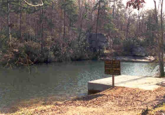
|
Pat went down a driveway to get this picture of Ravine Lake (which is
where we took the name of the dam).
|

|
|
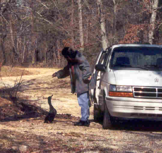
While coming back, some of the local "wild" life started
following him back to the van.
|
|
|
This guy was pretty insistant that we pay a toll. Fortunately we had
some bread in the van!
|

|
|
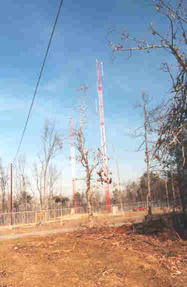
From the Airstrip we could see a lookout tower to the west that looked
like it should have been in or close to the resort, but we were never
able to find it. The lady at the resort told us where she thought it
was, and as we were looking for the access road, Jan got a glimpse of it
through the trees. We had never before been able to see it from that
road. When we found the access road, the gate was open! So, in we
went...
|
|
|
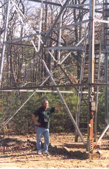
... and bagged that sucker!
|
|
|
This is the reason our luck changed. This is probably a county
communications complex. You can see the truck inside the fence, but we
couldn't find anyone to talk to (I think it was about lunch time). We
figure that they cleared enough trees to allow the tower to be seen from
the road, and we were lucky enough to go by there while they were
working on the new towers and had the gate open. We decided against
climbing the tower because we probably weren't supposed
to be there in the first place, and the wooden treads on the stairway
didn't look to be in that good of shape. So we took some pictures, paid
our respects, and left.
|
|
This is just some of the things to see and do in and around the park. We have
stayed there at least a dozen times, yet it always seems that we find
something new to explore every time we go. Very Highly Recommended!
|